


Tags:
Journalism of Courage

All about the revised Green India Mission to increase forest cover, address climate change

International Yoga Day: Why is it hard to pinpoint the origin of yoga?

QA::Why Madhya Pradesh CM's wish to count snakes and rear king cobras is unfeasible

What new Registration Bill says, why it was introduced
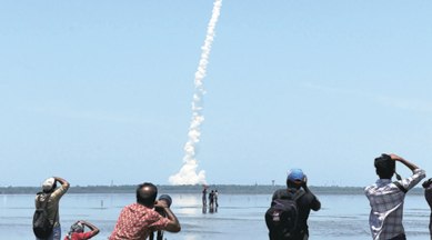
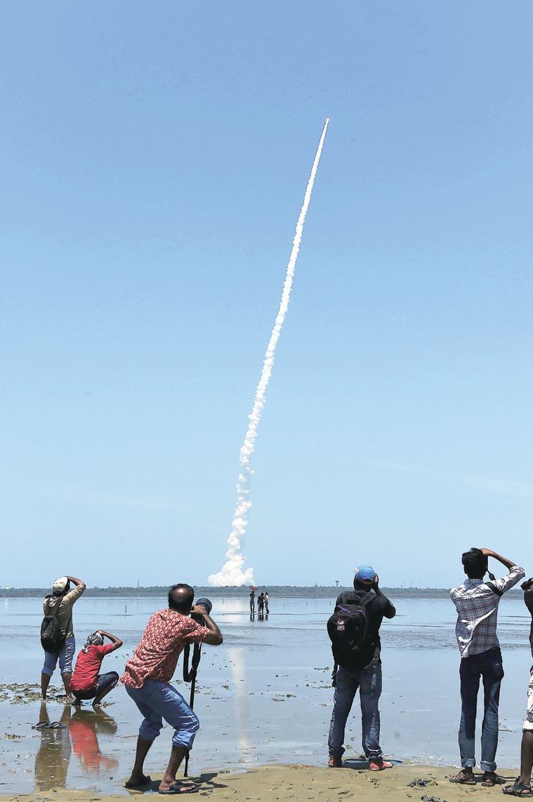
The IRNSS 1-G satellite, launched on Thursday, is the seventh member of the Indian Regional Navigation Satellite System (IRNSS), completing a constellation of satellites in geosynchronous and geostationary orbits that will give Indian civilian and military users, and their partners, access to a dedicated satellite navigation system that will not be dependent on foreign governments or suppliers.

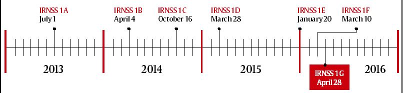
Schedule of Launches, 2013-16
Mission Basics
The Satellite
IRNSS-1G, seventh of the Indian Regional Navigation Satellite System (IRNSS). Like its six predecessors, had a lift-off mass of 1,425 kg. All 7 satellites are configured identically.
The Vehicle
Polar Satellite Launch Vehicle, in its 35th (and 34th consecutively successful) flight. All IRNSS launches used the most powerful ‘XL’ version of PSLV, equipped with 6 strap-ons, each with 12 tonnes of propellant.
The Orbits
3 of the 7 satellites will be located in suitable orbital slots in geostationary orbit; remaining four will be in geosynchronous orbits with the required inclination and equatorial crossings in two different planes. IRNSS-1G was placed in a Sub-Geosynchronous Transfer Orbit (Sub-GTO) about 20 minutes after lift-off.
The Service
IRNSS will provide Standard Positioning Service (SPS) to all users, and an encrypted Restricted Service (RS) to authorised users. IRNSS will provide a position accuracy better than 20 metres in the primary
service area.
The Applications
Terrestrial, aerial and marine navigation; disaster management; vehicle tracking and fleet management; integration with mobile phones; precise timing; mapping and geodetic data capture; terrestrial navigation aid for hikers and travellers; visual and voice navigation for drivers.
The Service Areas
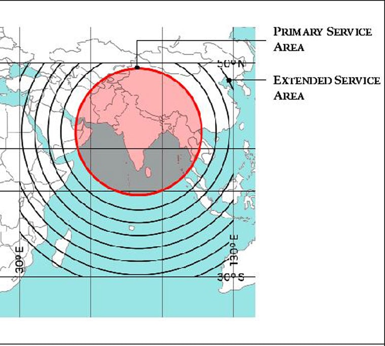
* The regional navigation satellite system will provide accurate position information service to users in India and the region, extending up to 1,500 km from its boundary, which is its Primary Service Area. Beyond that will lie an Extended Service Area, that will extend up to the edges of the area enclosed by the rectangle imagined by latitudes 30 degrees South and 50 degrees North, and longitudes 30 degrees East and 130 degrees East.
Source: ISRO

