


© The Indian Express Pvt Ltd
Tags:

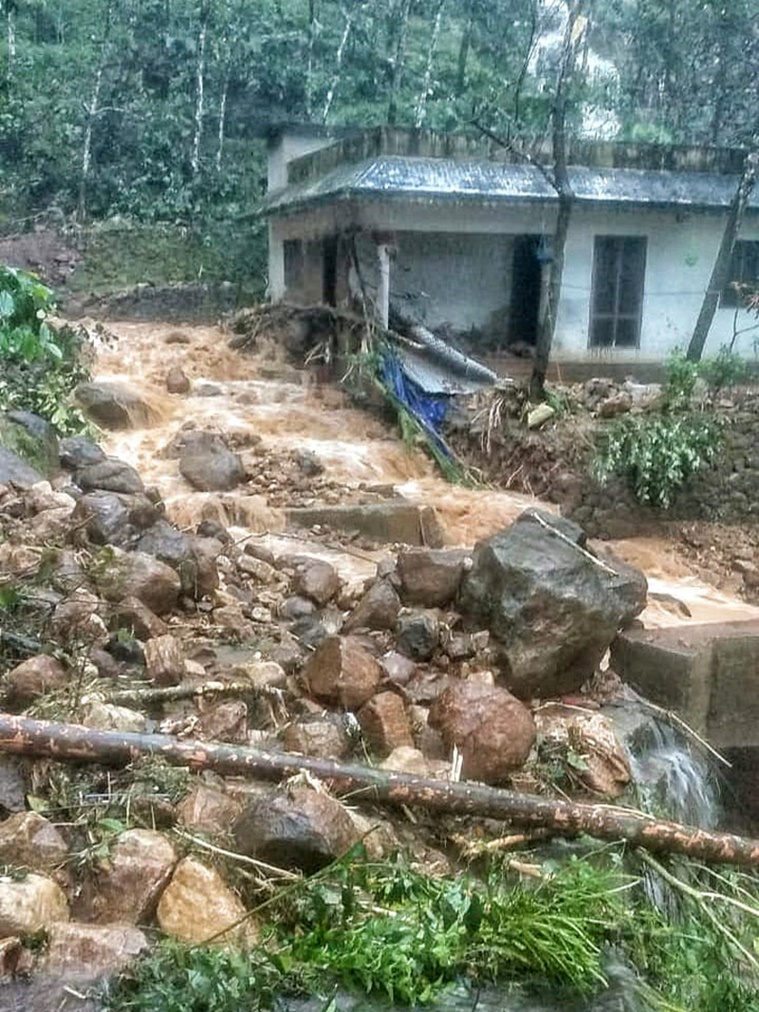
After two years, rain fury and floods have returned to haunt parts of central and southern Kerala districts. On Saturday, some bridges and a number of roads were washed away in flash floods. In Kottayam district — among the worst-hit — the Army and the Air Force have been deployed to carry out rescue operations.
A low pressure system developed in the east-central Arabian Sea on October 14. This system moved closer to Kerala coast and triggered severe weather.
Under the influence of this system, Kerala experienced heavy to very heavy rain (115.5mm to 204.4mm in 24-hours), and extremely heavy rain (over 204.4mm in 24-hours) in at least six of its southern districts since Thursday.
On Saturday, the six-hour rainfall recorded between 12noon and 6pm at some places were Thodupuzha – 145.mm, Cheruthoni – 142.2mm, Konni – 125mm, Thenmala – 120.5mm, Vyanthala – 95mm, Kottarakara – 77mm, Pallurthy – 66mm.
Flash floods, mudslides and landslides were reported in most districts located between central and southern Kerala on Saturday, which included Thrissur, Ernakulam, Idukki, Kottayam, Alappuzha, Pathanamthitta, Kollam and Thiruvananthapuram.

This year, the southwest monsoon withdrawal has been significantly delayed. It has withdrawn completely from west, north, central and eastern India regions, but continues to remain active in the southern peninsula. With the withdrawal entering the peninsula regions, southern states, including Kerala, have reported thunderstorms for over a week now.
But the rainfall during the last four days is mainly a localised phenomenon triggered due to the low-pressure system formed in the Arabian Sea. As on Saturday, the low pressure system continued to persist over Kerala.
While rainfall is common in October in Kerala, associated with the Northeast monsoon, such intense and localised spells are not frequent. This season, the onset of the northeast monsoon is unlikely till next week.
The IMD has forecast a continuation in the heavy rainfall activity over Kerala and Mahe till Sunday morning, after which the rain intensity is expected to reduce.
However, the Met office has sounded a moderate- to high-intensity flash flood threat warning of a likely recurrence over Thrissur, Ernakulam, Idukki, Kottayam, Alappuzha, Pathanamthitta, Kollam and Thiruvananthapuram districts on Sunday. There could be surface run-offs along with inundation at low lying areas in these districts. All these districts remain under a ‘red’ alert till early Monday.
There are no weather warnings for Kerala from Monday.
Newsletter | Click to get the day’s best explainers in your inbox

